

High Resolution Monitoring with Substantial Spatial Detail
Some of the most interesting science questions of water flow and transport processes require long term observations with high temporal and spatial resolution. A nested monitoring approach was therefore adopted for the HOAL consisting of base monitoring, dedicated monitoring and sampling, and individual experiments, involving more than 300 sensors with a typical resolution of 1 minute.
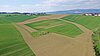
A substantial number of high resolution raingauges and stream gauges were chosen as the base monitoring setup. Basic chemical and physical parameters are monitored by online sensors and regular grab sampling. A weather station was set up to monitor the energy fluxes at the land-atmosphere interface. Spatial sampling to characterise the catchment include Lidar for high definition topography, soil mapping and sampling.
As part of the dedicated monitoring and sampling strategy, a soil moisture network within the catchment and three eddy correlation stations were set up. Faecal indicators and water quality characteristics are monitored to understand the dynamics of faecal contamination and nutrient fluxes.
Field campaigns are being conducted over limited periods of time to obtain more in-depth understanding of the processes at the field scale. Examples include tracer tests in the stream to elucidate stream aquifer interactions and a field campaign dedicated to measuring transpiration and bare soil evaporation separately. A small number of experiments are conducted with controlled boundary conditions such as resuspension experiments in the stream.
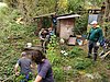
The HOAL is located within walking distance of the premises of the Institute for Land and Water Management Research which vastly facilitates the day-to-day maintenance of the instruments and experimental setups. Most instruments have been connected to the power grid and to a high speed glassfibre Local Area Network which further assists data management, remote monitoring of the functioning of the instruments and the short term planning of experiments.
